Human Dimensions of Forest Regeneration
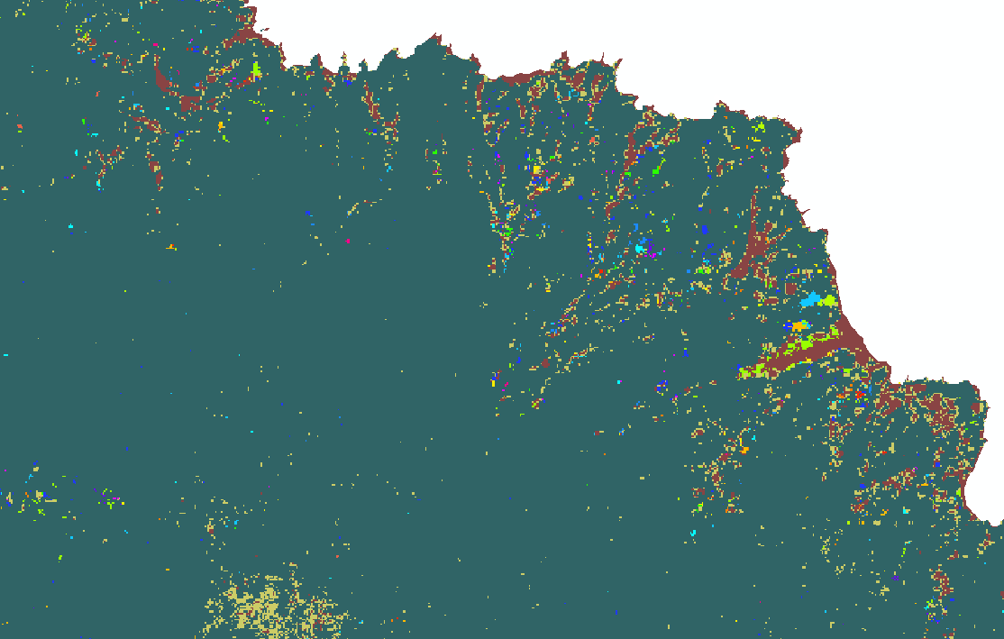
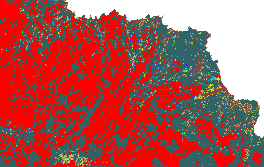
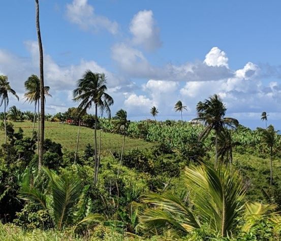
Dominica is recognized as a carbon-neutral country due to its extensive tropical rainforest, however the island lost over 80% of its tree cover as a result of Hurricane Maria in 2017. In a place where people live close to the land, how do these livelihood activities impact forest regrowth after a major natural disaster? This new project utilizes the Hansen et al. model of global forest change to identify and track areas of exceptional change in tree cover: “bright spots” where forest gain has surpassed expected levels and “dark spots” where losses have expanded and/or forests have failed to rebound. This geospatial analysis will guide future mixed methods fieldwork to investigate the human-environment dynamics of post-disaster forest regeneration.
Building Geospatial Capacities in Rural Communities
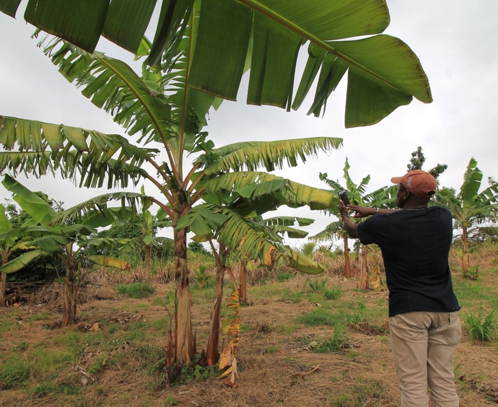
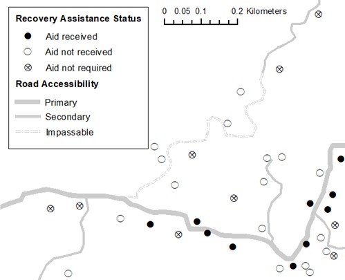
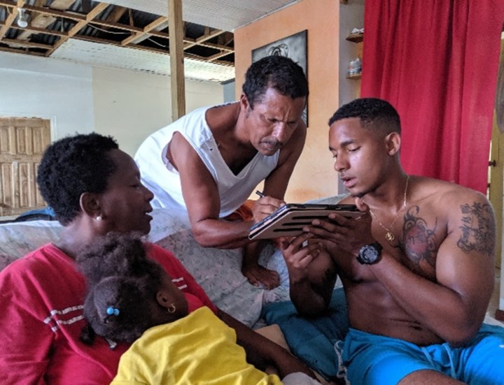
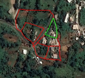
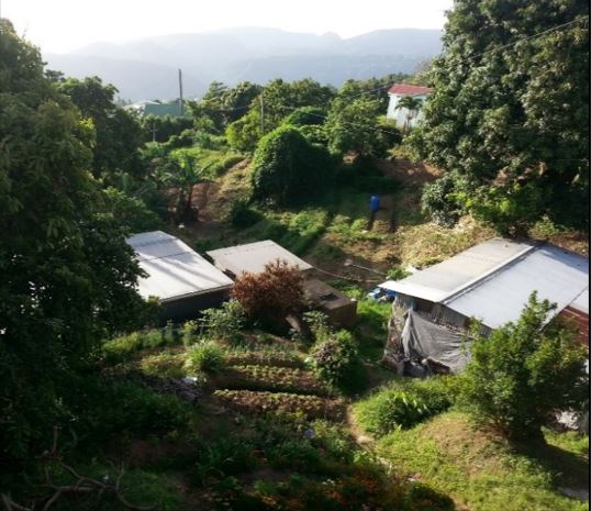
Although access to GIS technology and infrastructure has steadily increased in many regions of the world, the use and impacts of these resources often remain limited by lack of exposure and training. To help bridge this capacity gap in Dominica, I worked with local stakeholders to develop a grassroots geospatial training initiative. Participants in this project learned how to collect spatial data and make digital maps using free GIS technology. Communities have used these maps to address disparities in disaster recovery aid, recurrence and spread of crop disease, farm productivity, and road access limitations.
Publications: King, Samantha. 2021. “GIS as a bridge across the digital divide: Engaging participatory methods to build capacity in research communities.” Practicing Anthropology. 43 (1).
Awards: This project won first runner up for the 2020 Student Achievement Award from the National Association for the Practice of Anthropology for best original research in any applied context.
Spatializing Sustainability: How Histories of Land Use Structure Current Possibilities for Agricultural Success and Disaster Recovery
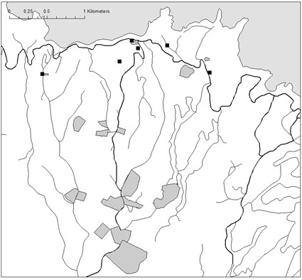
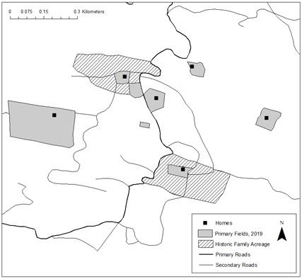
Histories of agriculture in the Caribbean are often associated with the boom and bust of plantation-based export economies, yet the ecological constraints of more mountainous islands enabled alternative configurations of farming to emerge and, under certain conditions, thrive. This project integrates participatory GIS mapping with archival and ethnographic data collected in smallholder farming communities in Dominica to explore how spatial and temporal dynamics of landscape change condition current possibilities for sustainable agricultural livelihoods. The research offers important new insights on rural development, agricultural sustainability, and disaster recovery for the wider Caribbean region.
